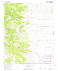
1968 Map of Stockton Hill
USGS Topo · Published 1980About this map
The Cerbat Mountains dominate this western Arizona landscape, where the rugged slopes are pocketed with a high density of named mining claims. At the base of Stockton Hill, the settlement of Stockton serves as a focal point for operations like the Stockton Mine and the Jordan Mine. This era of mineral extraction is well-documented through a network of steep trails and roads connecting high-elevation sites such as the White Eagle Mine and De La Fontaine Mine to the lower basins.
Find a feature on this map
49 named features on this map. Tap any name to fly to it.
Don’t see what you’re looking for? This feature index may not catch every label — zoom into the map to look around manually.
Map Details
Editions of this 1968 Stockton Hill Map
4 editions found
Other maps of this area

1886 · Diamond Creek
USGS Topo · 1:250,000

1886 · Camp Mohave
USGS Topo · 1:250,000

1892 · Diamond Creek
USGS Topo · 1:250,000

1892 · Camp Mohave
USGS Topo · 1:250,000

1939 · Chloride
USGS Topo · 1:48,000

1942 · Camp Mohave
USGS Topo · 1:250,000

1944 · Chloride
USGS Topo · 1:62,500

1947 · Kingman
USGS Topo · 1:250,000

1948 · Kingman
USGS Topo · 1:250,000

1948 · Williams
USGS Topo · 1:250,000