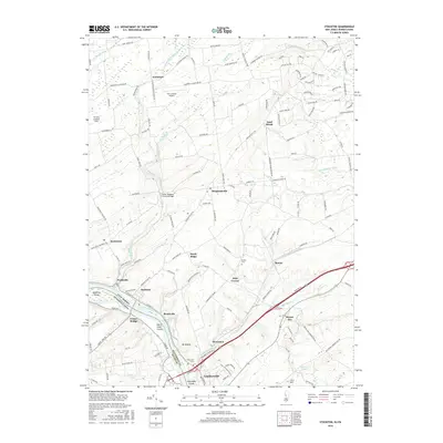
2016 Map of Stockton
USGS Topo · Published 2016About this map
Wickecheoke Creek flows southward through a landscape of established New Jersey hamlets and farm roads, eventually meeting the Delaware River at the historic borough of Stockton. This survey illustrates the intricate relationship between the waterway and early regional transport, featuring the Green Sergeant Covered Bridge as a primary landmark. Along the river’s edge, the Delaware and Raritan Canal runs parallel to the water, cutting past Prallsville and Brookville.
Find a feature on this map
139 named features on this map. Tap any name to fly to it.
Don’t see what you’re looking for? This feature index may not catch every label — zoom into the map to look around manually.
Map Details
Editions of this 2016 Stockton Map
This is the sole edition of this map. No revisions or reprints were ever made.
Other maps of this area

1890 · Easton
USGS Topo · 1:62,500

1890 · High Bridge
USGS Topo · 1:62,500

1890 · Lambertville
USGS Topo · 1:62,500

1890 · Doylestown
USGS Topo · 1:62,500

1891 · Easton
USGS Topo · 1:62,500

1891 · Lambertville
USGS Topo · 1:62,500

1891 · Doylestown
USGS Topo · 1:62,500

1894 · Lambertville
USGS Topo · 1:62,500

1898 · High Bridge
USGS Topo · 1:62,500

1900 · Raritan
USGS Topo · 1:125,000
Featured Places
- Raritan Township, NJ
- Solebury Township, PA
- East Amwell Township, NJ
- West Amwell Township, NJ
- Lambertville, NJ