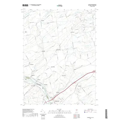
2019 Map of Stockton
USGS Topo · Published 2019About this map
The Delaware River forms a natural border between Hunterdon County and Pennsylvania, anchoring a landscape where river-town history and rural agriculture persist. Following the river's edge, the Delaware and Raritan Canal runs parallel to the bank, passing through Stockton and Brookville. This corridor is defined by its engineering heritage and early transport networks, including the nearby Green Sergeant Covered Bridge crossing Wickecheoke Creek.
Find a feature on this map
140 named features on this map. Tap any name to fly to it.
Don’t see what you’re looking for? This feature index may not catch every label — zoom into the map to look around manually.
Map Details
Editions of this 2019 Stockton Map
This is the sole edition of this map. No revisions or reprints were ever made.
Other maps of this area

1890 · Easton
USGS Topo · 1:62,500

1890 · High Bridge
USGS Topo · 1:62,500

1890 · Lambertville
USGS Topo · 1:62,500

1890 · Doylestown
USGS Topo · 1:62,500

1891 · Easton
USGS Topo · 1:62,500

1891 · Lambertville
USGS Topo · 1:62,500

1891 · Doylestown
USGS Topo · 1:62,500

1894 · Lambertville
USGS Topo · 1:62,500

1898 · High Bridge
USGS Topo · 1:62,500

1900 · Raritan
USGS Topo · 1:125,000
Featured Places
- Raritan Township, NJ
- Solebury Township, PA
- East Amwell Township, NJ
- West Amwell Township, NJ
- Lambertville, NJ