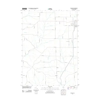
2012 Map of Stockton
USGS Topo · Published 2012About this map
The village of Stockton serves as the primary hub in this portion of Jo Daviess County, centered on the intersection of North Rush Street and East Front Avenue. To the south, the smaller settlement of Elmoville marks a quiet crossing near the winding course of the Plum River. This landscape is defined by its complex drainage network, where the N Fork Plum River and Middle Fork Plum River converge amidst a grid of rural roads named for local families and landmarks. Genealogists will find notable points of interest such as the Holy Cross Catholic Cem on the edge of Stockton and the Plum River Catholic Cem further south. The terrain's character is further highlighted by recreational and agricultural features, including the Stockton Golf Course and numerous small tributaries like Rush Cr, Lawhorn Cr, and Mud Run that carve through the countryside.
Find a feature on this map
58 named features on this map. Tap any name to fly to it.
Don’t see what you’re looking for? This feature index may not catch every label — zoom into the map to look around manually.
Map Details
Editions of this 2012 Stockton Map
This is the sole edition of this map. No revisions or reprints were ever made.
Other maps of this area

1892 · Savanna
USGS Topo · 1:62,500

1911 · Elizabeth
USGS Topo · 1:62,500

1936 · Elizabeth
USGS Topo · 1:62,500

1937 · Lena
USGS Topo · 1:48,000

1942 · Mt Carroll
USGS Topo · 1:62,500

1942 · Lena
USGS Topo · 1:62,500

1943 · Lena
USGS Topo · 1:62,500

1944 · Mt Carroll
USGS Topo · 1:62,500

1952 · Savanna
USGS Topo · 1:62,500

1953 · Blackhawk
USGS Topo · 1:24,000
Featured Places
- Stockton, IL
- Stockton Township, IL
- Derinda Township, IL
- Woodbine Township, IL
- Pleasant Valley Township, IL