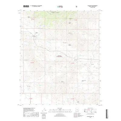
2018 Map of Stockton Pass
USGS Topo · Published 2018About this map
Coronado National Forest encompasses the high-altitude terrain of the Pinaleno Mountains, where several notable summits and natural springs define the Graham County landscape. The namesake Stockton Pass provides a transition through the mountains, flanked by Maverick Mtn and the steep elevations of Ladybug Peak. The area is characterized by a network of drainage systems including Stockton Pass Wash, Hog Canyon Wash, and Gillespie Wash, which cut through the complex topography. Historical water sources such as Bootlegger Spring, Mush-Barrel Spring, and Shake Spring suggest a long history of human and livestock use in this arid environment. Other localized landmarks like Ladybug Saddle and Kane Spring Mtn highlight the specific naming conventions used by early travelers and forest rangers to navigate this stretch of the Coronado range.
Find a feature on this map
46 named features on this map. Tap any name to fly to it.
Don’t see what you’re looking for? This feature index may not catch every label — zoom into the map to look around manually.
Map Details
Editions of this 2018 Stockton Pass Map
This is the sole edition of this map. No revisions or reprints were ever made.
Other maps of this area

1922 · Willcox
USGS Topo · 1:125,000

1942 · Mt. Graham
USGS Topo · 1:62,500

1943 · Willcox
USGS Topo · 1:62,500

1944 · Fisher Hills
USGS Topo · 1:62,500

1945 · Mt. Graham
USGS Topo · 1:62,500

1954 · Silver City
USGS Topo · 1:250,000

1957 · Luzena
USGS Topo · 1:62,500

1958 · Silver City
USGS Topo · 1:250,000

1958 · Willcox
USGS Topo · 1:62,500

1962 · Silver City
USGS Topo · 1:250,000