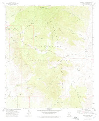
1972 Map of Stockton Pass
USGS Topo · Published 1975About this map
Pinaleno Mountains and Kane Spring Mountain dominate this corner of the Coronado National Forest during the early 1970s. The landscape is defined by a dense network of high-elevation water sources including Alder Spring, Trap Spring, and Kane Spring, which support the remote operations of the C N Ranch and Jernigan Ranch. This topography highlights the transition from the high peaks of Ladybug Peak down through Stockton Pass, where a public Picnic Area sits along the primary route through the range.
Find a feature on this map
62 named features on this map. Tap any name to fly to it.
Don’t see what you’re looking for? This feature index may not catch every label — zoom into the map to look around manually.
Map Details
Editions of this 1972 Stockton Pass Map
This is the sole edition of this map. No revisions or reprints were ever made.
Other maps of this area

1922 · Willcox
USGS Topo · 1:125,000

1942 · Mt. Graham
USGS Topo · 1:62,500

1943 · Willcox
USGS Topo · 1:62,500

1944 · Fisher Hills
USGS Topo · 1:62,500

1945 · Mt. Graham
USGS Topo · 1:62,500

1954 · Silver City
USGS Topo · 1:250,000

1957 · Luzena
USGS Topo · 1:62,500

1958 · Silver City
USGS Topo · 1:250,000

1958 · Willcox
USGS Topo · 1:62,500

1962 · Silver City
USGS Topo · 1:250,000