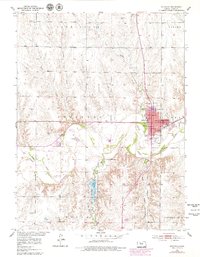
1953 Map of Stockton
USGS Topo · Published 1979About this map
The South Fork Solomon River defines the lower geography of this Rooks County region, where the town of Stockton serves as a hub for both the local agricultural economy and rail transit. The Missouri Pacific railroad cuts through the heart of the settlement, passing near key community landmarks like the Fairground, City Park, and the High School. Local history and genealogy are anchored by several burial sites, including the centrally located St Thomas Cemetery and the more outlying Old Stockton Cemetery and Hobart Cemetery.
Find a feature on this map
30 named features on this map. Tap any name to fly to it.
Don’t see what you’re looking for? This feature index may not catch every label — zoom into the map to look around manually.
Map Details
Editions of this 1953 Stockton Map
3 editions found
Other maps of this area

1893 · Phillipsburg
USGS Topo · 1:125,000

1896 · Plainville
USGS Topo · 1:125,000

1952 · Webster Dam
USGS Topo · 1:24,000

1953 · Woodston NW
USGS Topo · 1:24,000

1953 · Stockton
USGS Topo · 1:24,000

1955 · Beloit
USGS Topo · 1:250,000

1959 · Beloit
USGS Topo · 1:250,000

1961 · Kirwin SW
USGS Topo · 1:24,000

1969 · Stockton SW
USGS Topo · 1:24,000

1972 · Glade SW
USGS Topo · 1:24,000