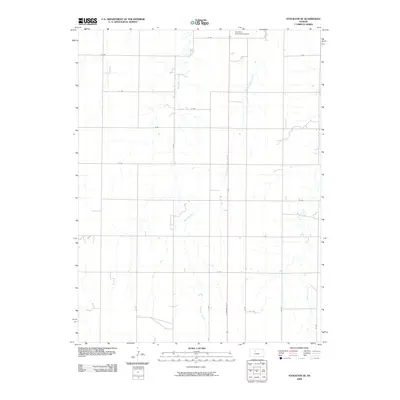
2009 Map of Stockton SE
USGS Topo · Published 2009About this map
Boxelder Creek and Roberts Roost Creek carve through the agricultural landscape southeast of the Rooks County seat in the early 21st century. The terrain is organized by a systematic grid of section-line roads, such as O Rd and 20 Rd, reflecting the enduring influence of the Public Land Survey System on the Kansas plains. This map captures the area's rural character and its integration with local transportation infrastructure, most notably where N Washington St extends toward the northern reaches of the quadrangle. The Stockton Municipal Airport serves as a modern landmark at the northern edge, indicating the continued evolution of regional connectivity in a landscape otherwise dominated by the serpentine paths of prairie waterways like Elm Creek.
Find a feature on this map
19 named features on this map. Tap any name to fly to it.
Don’t see what you’re looking for? This feature index may not catch every label — zoom into the map to look around manually.
Map Details
Editions of this 2009 Stockton SE Map
This is the sole edition of this map. No revisions or reprints were ever made.
Other maps of this area

1896 · Plainville
USGS Topo · 1:125,000

1952 · Webster Dam
USGS Topo · 1:24,000

1953 · Woodston NW
USGS Topo · 1:24,000

1953 · Stockton
USGS Topo · 1:24,000

1955 · Beloit
USGS Topo · 1:250,000

1959 · Beloit
USGS Topo · 1:250,000

1969 · Stockton SW
USGS Topo · 1:24,000

1978 · Plainville
USGS Topo · 1:24,000
1978 · Codell
USGS Topo · 1:24,000
1978 · Twin Mound
USGS Topo · 1:24,000