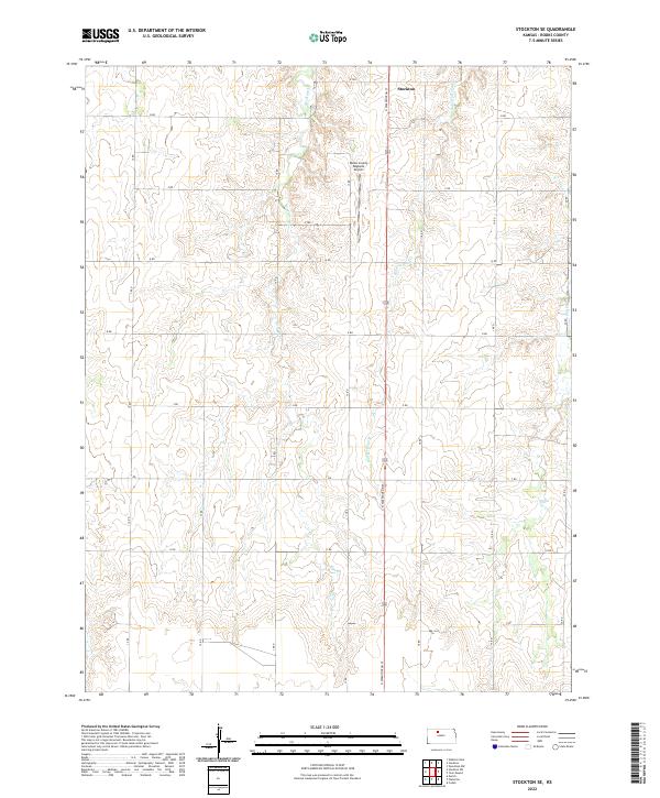
2022 Map of Stockton SE
USGS Topo · Published 2022About this map
Stockton sits at the northern edge of this Rooks County landscape, where the High Plains terrain is etched by a network of drainage systems. The Rooks County Regional Airport serves as a modern landmark central to the quadrangle, situated just west of the N Washington St corridor. The geography is defined by the intermittent flow of Boxelder Cr, Roberts Roost Cr, and Elm Cr, which carve through the prairie to form a rhythmic pattern of ridges and draws. This 2022 survey illustrates the enduring grid of the Public Land Survey System, with section lines clearly marked by rural roads like O Rd and 20 Rd. The map provides a precise view of the rural infrastructure and land divisions that continue to shape the agricultural character of north-central Kansas.
Find a feature on this map
25 named features on this map. Tap any name to fly to it.
Don’t see what you’re looking for? This feature index may not catch every label — zoom into the map to look around manually.
Map Details
Editions of this 2022 Stockton SE Map
This is the sole edition of this map. No revisions or reprints were ever made.
Other maps of this area

1896 · Plainville
USGS Topo · 1:125,000

1952 · Webster Dam
USGS Topo · 1:24,000

1953 · Woodston NW
USGS Topo · 1:24,000

1953 · Stockton
USGS Topo · 1:24,000

1955 · Beloit
USGS Topo · 1:250,000

1959 · Beloit
USGS Topo · 1:250,000

1969 · Stockton SW
USGS Topo · 1:24,000

1978 · Plainville
USGS Topo · 1:24,000
1978 · Codell
USGS Topo · 1:24,000
1978 · Twin Mound
USGS Topo · 1:24,000