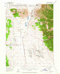
1955 Map of Stockton
USGS Topo · Published 1962About this map
South Mountain and the Oquirrh Mountains frame this 1950s survey of Tooele County, where the transition from a mining-driven economy to a military and agricultural one is clearly visible. The landscape is marked by the presence of the Tooele Ordnance Depot, which occupies a significant portion of the valley floor. In the canyons of the Oquirrh range, the legacy of Utah's silver and gold booms is preserved in the location of Ophir and the designated Gisborn (Ghost Town), while the Honest Miner Mine and Tip Top Mine dot the slopes near Edwards Pass.
Find a feature on this map
56 named features on this map. Tap any name to fly to it.
Don’t see what you’re looking for? This feature index may not catch every label — zoom into the map to look around manually.
Map Details
Editions of this 1955 Stockton Map
2 editions found

Other maps of this area

1885 · Tooele Valley
USGS Topo · 1:250,000

1915 · Fairfield
USGS Topo · 1:62,500

1917 · Fairfield
USGS Topo · 1:62,500

1918 · Stockton
USGS Topo · 1:62,500

1947 · Fivemile Pass
USGS Topo · 1:62,500

1949 · Fivemile Pass
USGS Topo · 1:24,000

1952 · Bingham Canyon
USGS Topo · 1:24,000

1953 · Tooele
USGS Topo · 1:250,000

1955 · Timpie
USGS Topo · 1:62,500

1955 · Deseret Peak
USGS Topo · 1:62,500