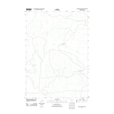
2012 Map of Stone Barn Camp
USGS Topo · Published 2012About this map
McCullough Peaks dominate the landscape in this Wyoming survey, where a network of ephemeral water sources supports the high-desert terrain. The namesake Stone Barn Camp and nearby Stone Barn Spring indicate the legacy of rangeland management and seasonal livestock operations in Park County. Water management is a primary feature of the area, evidenced by curiously named catchments like Back Scratcher Reservoir and Crazy Quilt Reservoir. These small-scale irrigation or livestock reservoirs are fed by the intermittent flows of Whistle Cr and its tributary, W Br Whistle Cr. The presence of Black Spring further illustrates the critical importance of specific water points in an otherwise arid region defined by steep drainages and open country.
Find a feature on this map
9 named features on this map. Tap any name to fly to it.
Don’t see what you’re looking for? This feature index may not catch every label — zoom into the map to look around manually.
Map Details
Editions of this 2012 Stone Barn Camp Map
This is the sole edition of this map. No revisions or reprints were ever made.
Other maps of this area

1911 · Oregon Basin
USGS Topo · 1:62,500

1913 · Oregon Basin
USGS Topo · 1:62,500

1951 · Y U Bench NW
USGS Topo · 1:24,000

1955 · Cody
USGS Topo · 1:250,000

1958 · Cody
USGS Topo · 1:250,000

1962 · Cody
USGS Topo · 1:250,000

1966 · Stone Barn Camp
USGS Topo · 1:24,000

1966 · Gilmore Hill NW
USGS Topo · 1:24,000

1966 · Corbett Dam
USGS Topo · 1:24,000

1966 · Gilmore Hill
USGS Topo · 1:24,000