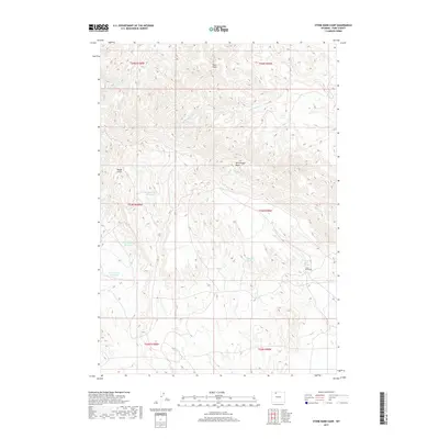
2017 Map of Stone Barn Camp
USGS Topo · Published 2017About this map
McCullough Peaks dominate this high-desert landscape in Park County, where the terrain is defined by complex drainage networks and isolated water sources. This 2017 survey details the semi-arid character of the region, featuring several small reservoirs such as McLean Gulch Reservoir, Back Scratcher Reservoir, and the uniquely named Crazy Quilt Reservoir. These vital catchments, along with perennial points like Stone Barn Spring and Black Spring, illustrate the infrastructure required for land management and livestock in the Wyoming interior. The map centers on the Stone Barn Camp area, situated near the confluence of several intermittent streams, including Whistle Cr and its western branches. The intricate contouring reveals the erosional patterns of Rough Gulch and Roan Wash, providing a technical look at the physical geography of the Big Horn Basin floor.
Find a feature on this map
19 named features on this map. Tap any name to fly to it.
Don’t see what you’re looking for? This feature index may not catch every label — zoom into the map to look around manually.
Map Details
Editions of this 2017 Stone Barn Camp Map
This is the sole edition of this map. No revisions or reprints were ever made.
Other maps of this area

1911 · Oregon Basin
USGS Topo · 1:62,500

1913 · Oregon Basin
USGS Topo · 1:62,500

1951 · Y U Bench NW
USGS Topo · 1:24,000

1955 · Cody
USGS Topo · 1:250,000

1958 · Cody
USGS Topo · 1:250,000

1962 · Cody
USGS Topo · 1:250,000

1966 · Stone Barn Camp
USGS Topo · 1:24,000

1966 · Gilmore Hill NW
USGS Topo · 1:24,000

1966 · Corbett Dam
USGS Topo · 1:24,000

1966 · Gilmore Hill
USGS Topo · 1:24,000