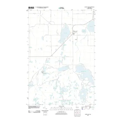
2010 Map of Stone Lake
USGS Topo · Published 2010About this map
Glacial lakes and wetlands define the landscape surrounding the community of Stone Lake, where the local Stone Lake Post Office and Stone Lake Water Tower anchor the small lakeside settlement. The area is dominated by an intricate network of water bodies, including the large Sand Lake to the east and the sprawling Sissabagama Lake to the south. The hydrography of the region is further managed by infrastructure such as the Slim Creek Dam and the Slim Creek 2WP220 Dam, regulating the flow of Slim Creek through the western timberlands.
Find a feature on this map
73 named features on this map. Tap any name to fly to it.
Don’t see what you’re looking for? This feature index may not catch every label — zoom into the map to look around manually.
Map Details
Editions of this 2010 Stone Lake Map
This is the sole edition of this map. No revisions or reprints were ever made.
Other maps of this area

1944 · Couderay
USGS Topo · 1:48,000

1945 · Meteor
USGS Topo · 1:48,000

1948 · Couderay
USGS Topo · 1:48,000

1948 · Stone Lake
USGS Topo · 1:48,000

1949 · Meteor
USGS Topo · 1:48,000

1949 · Rice Lake
USGS Topo · 1:48,000

1950 · Stone Lake
USGS Topo · 1:48,000

1951 · Rice Lake
USGS Topo · 1:48,000

1953 · Rice Lake
USGS Topo · 1:250,000

1959 · Rice Lake
USGS Topo · 1:250,000