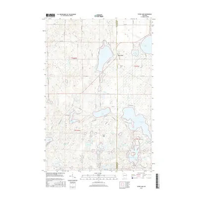
2015 Map of Stone Lake
USGS Topo · Published 2015About this map
Stone Lake sits at the intersection of Co Hwy A and Co Hwy BB, serving as a central point for this water-rich corridor along the Washburn Co and Sawyer Co border. The landscape is defined by an intricate network of glacial lakes and flowages, with major bodies of water like Sand Lake and Sissabagama Lake anchoring the eastern edge. Local history is grounded at the Evergreen Cem and the nearby Lakewood Lodge Airport, which indicates the area's development as a seasonal destination for aviation and outdoor enthusiasts.
Find a feature on this map
90 named features on this map. Tap any name to fly to it.
Don’t see what you’re looking for? This feature index may not catch every label — zoom into the map to look around manually.
Map Details
Editions of this 2015 Stone Lake Map
This is the sole edition of this map. No revisions or reprints were ever made.
Other maps of this area

1944 · Couderay
USGS Topo · 1:48,000

1945 · Meteor
USGS Topo · 1:48,000

1948 · Couderay
USGS Topo · 1:48,000

1948 · Stone Lake
USGS Topo · 1:48,000

1949 · Meteor
USGS Topo · 1:48,000

1949 · Rice Lake
USGS Topo · 1:48,000

1950 · Stone Lake
USGS Topo · 1:48,000

1951 · Rice Lake
USGS Topo · 1:48,000

1953 · Rice Lake
USGS Topo · 1:250,000

1959 · Rice Lake
USGS Topo · 1:250,000