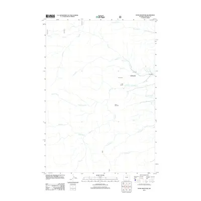
2012 Map of Stone Mountain
USGS Topo · Published 2012About this map
Saddlestring and the H F Bar Ranch anchor this landscape in Johnson County, where the eastern foothills of the Bighorn Mountains meet a complex network of managed waterways. The presence of the Jim Crow Ditch and Mowry Basin Ditch alongside Mowry Cr indicates a long-standing reliance on irrigation infrastructure to support ranching operations in this arid environment. Terrain features such as Stone Mountain and the distinctive stretch of land known as The Speedway define the area's geography north of Red Canyon. Water courses like Balm of Gilead Cr and the various forks of N Fork Sayles Cr and S Fork Sayles Cr drain the high ground, while Rock Creek Rd provides the primary transit corridor through this rural Wyoming territory.
Find a feature on this map
21 named features on this map. Tap any name to fly to it.
Don’t see what you’re looking for? This feature index may not catch every label — zoom into the map to look around manually.
Map Details
Editions of this 2012 Stone Mountain Map
This is the sole edition of this map. No revisions or reprints were ever made.
Other maps of this area

1895 · Dayton
USGS Topo · 1:125,000

1899 · Cloud peak
USGS Topo · 1:125,000

1900 · Fort McKinney
USGS Topo · 1:125,000

1901 · Cloud Peak
USGS Topo · 1:125,000

1901 · Dayton
USGS Topo · 1:125,000

1903 · Fort McKinney
USGS Topo · 1:125,000

1909 · Sheridan
USGS Topo · 1:125,000

1911 · Sheridan
USGS Topo · 1:125,000

1955 · Sheridan
USGS Topo · 1:250,000

1958 · Sheridan
USGS Topo · 1:250,000