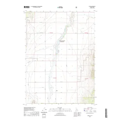
2020 Map of Stone
USGS Topo · Published 2020About this map
Stone sits at the heart of this high-desert agricultural landscape, located in the southern reaches of Oneida County near the state line. The settlement is defined by a grid of rural roads and irrigation patterns that serve the surrounding valley. To the north, the protected acreage of the Curlew National Grassland encompasses the riparian corridor of Deep Creek, providing a stark contrast to the neighboring cultivated fields.
Find a feature on this map
28 named features on this map. Tap any name to fly to it.
Don’t see what you’re looking for? This feature index may not catch every label — zoom into the map to look around manually.
Map Details
Editions of this 2020 Stone Map
This is the sole edition of this map. No revisions or reprints were ever made.
Other maps of this area

1954 · Pocatello
USGS Topo · 1:250,000

1954 · Brigham City
USGS Topo · 1:250,000

1958 · Pocatello
USGS Topo · 1:250,000

1958 · Brigham City
USGS Topo · 1:250,000

1962 · Brigham City
USGS Topo · 1:250,000

1968 · Rattlesnake Pass
USGS Topo · 1:24,000

1968 · Snowville
USGS Topo · 1:24,000

1968 · Monument Peak NE
USGS Topo · 1:24,000

1973 · The Cove
USGS Topo · 1:24,000
1973 · Stone
USGS Topo · 1:24,000