
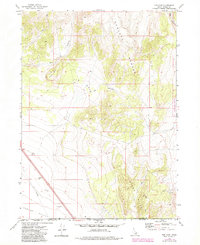
1973 Map of The Cove
USGS Topo · Published 1976About this map
The Cove and the high peaks of the Sublett Range dominate this Idaho landscape at the border of Oneida and Box Elder counties. The terrain is defined by deep drainage systems like Cow Canyon and Dry Canyon that cut through the mountain slopes toward the Curlew Valley. Geologists and local historians can trace the utilitarian infrastructure of the 1970s, including a prominent pipeline and several borrow pits that suggest road maintenance or construction activity in this high-altitude region. Along the western edge, Table Mtn stands as a clear landmark above a network of jeep trails that navigate the ridges. To the southeast, the Stone Hills rise from the valley floor, providing a detailed look at the physical geography before modern development altered these remote drainages.
Find a feature on this map
13 named features on this map. Tap any name to fly to it.
Don’t see what you’re looking for? This feature index may not catch every label — zoom into the map to look around manually.
Map Details
Editions of this 1973 The Cove Map
2 editions found
Other maps of this area

1954 · Pocatello
USGS Topo · 1:250,000

1954 · Brigham City
USGS Topo · 1:250,000

1958 · Pocatello
USGS Topo · 1:250,000

1958 · Brigham City
USGS Topo · 1:250,000

1962 · Brigham City
USGS Topo · 1:250,000

1968 · Monument Peak NW
USGS Topo · 1:24,000

1968 · Snowville
USGS Topo · 1:24,000

1968 · Monument Peak NE
USGS Topo · 1:24,000

1973 · Juniper
USGS Topo · 1:24,000

1973 · Black Pine
USGS Topo · 1:24,000