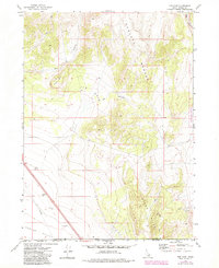
1973 Map of The Cove
USGS Topo · Published 1984About this map
The Sublett Range and Stone Hills dominate this high-desert boundary between Idaho and Utah, where the terrain drops sharply into the expansive Curlew Valley. This landscape is defined by the transition from the steep, canyon-riven slopes of The Cove and Table Mtn to the managed landscapes of the Curlew National Grasslands. The map reveals a land utilized for its raw materials and utility, marked by a prominent Pipeline cutting across the southwestern flats and several industrial excavations including a Borrow Pit and Gravel Pit. Drainage patterns like Cow Canyon and Dry Canyon illustrate the arid nature of this region during the 1970s, as a network of Jeep Trails provides the primary access into the more difficult elevations of the range.
Find a feature on this map
15 named features on this map. Tap any name to fly to it.
Don’t see what you’re looking for? This feature index may not catch every label — zoom into the map to look around manually.
Map Details
Editions of this 1973 The Cove Map
2 editions found
Other maps of this area

1954 · Pocatello
USGS Topo · 1:250,000

1954 · Brigham City
USGS Topo · 1:250,000

1958 · Pocatello
USGS Topo · 1:250,000

1958 · Brigham City
USGS Topo · 1:250,000

1962 · Brigham City
USGS Topo · 1:250,000

1968 · Monument Peak NW
USGS Topo · 1:24,000

1968 · Snowville
USGS Topo · 1:24,000

1968 · Monument Peak NE
USGS Topo · 1:24,000

1973 · Juniper
USGS Topo · 1:24,000

1973 · The Cove
USGS Topo · 1:24,000