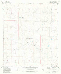
1980 Map of Stone Well
USGS Topo · Published 1980About this map
Fort Bliss Military Reservation (Mcgregor Range) dominates this high-desert terrain in Otero County, illustrating the significant land use dedicated to military training and missile testing in southern New Mexico during the late twentieth century. The landscape is defined by its sparse water resources, which were critical for ranching operations that predated or coexisted with the military presence. Important water points such as Stone Well, Antelope Well, and Cockleburr Tank are scattered across the quadrangle, serving as the primary landmarks in an otherwise open expanse. The presence of these named wells and tanks, alongside Sand Tank and Lake Tank, highlights the precarious nature of water management in this arid environment, where every named source represented a vital hub for movement and survival.
Find a feature on this map
10 named features on this map. Tap any name to fly to it.
Don’t see what you’re looking for? This feature index may not catch every label — zoom into the map to look around manually.
Map Details
Editions of this 1980 Stone Well Map
This is the sole edition of this map. No revisions or reprints were ever made.
Other maps of this area

1940 · Bassett Lake
USGS Topo · 1:62,500

1943 · Pendejo Wash
USGS Topo · 1:62,500

1943 · Bassett Lake
USGS Topo · 1:62,500

1954 · Carlsbad
USGS Topo · 1:250,000

1958 · Carlsbad
USGS Topo · 1:250,000

1959 · Alamo Mountain
USGS Topo · 1:62,500

1975 · Alamo Mountain NE
USGS Topo · 1:24,000
1975 · B T Ranch
USGS Topo · 1:24,000
1979 · Otero Mesa South
USGS Topo · 1:24,000

1979 · Crow Flats
USGS Topo · 1:100,000