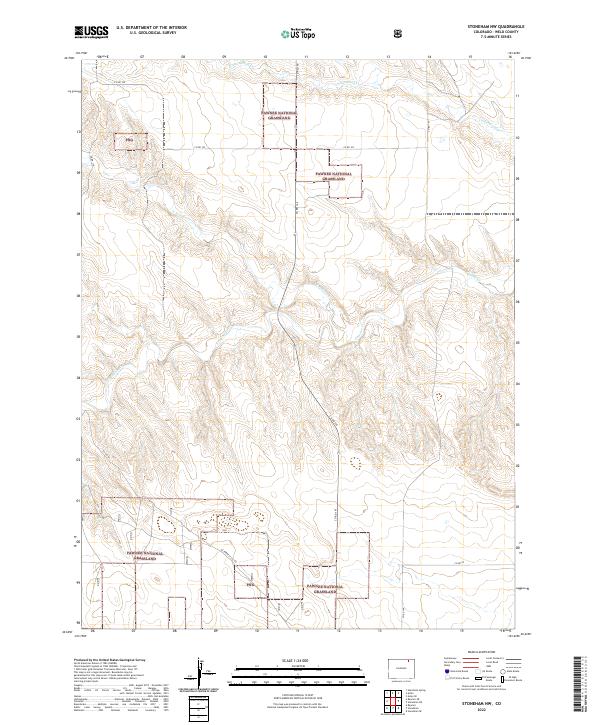
2022 Map of Stoneham NW
USGS Topo · Published 2022About this map
Pawnee National Grassland dominates this section of the High Plains, where the terrain is defined by the branching drainage systems of N Pawnee Cr, S Pawnee Cr, and the main stem of Pawnee Cr. The landscape is a mix of public and private lands, often marked by the Png abbreviation, reflecting the complex checkerboard of federal management and local ranching. In the northern reaches, Cottonwood Cr cuts through the shortgrass prairie near the border of t9n r57w and t9n r56w. A network of rural section-line roads, such as Co Rd 145 and Co Rd 102, provides the primary access across these open reaches. The presence of the US Forest Svc Rd highlights the intersection of public conservation and agricultural use that has shaped this corner of Weld County for decades.
Find a feature on this map
19 named features on this map. Tap any name to fly to it.
Don’t see what you’re looking for? This feature index may not catch every label — zoom into the map to look around manually.
Map Details
Editions of this 2022 Stoneham NW Map
This is the sole edition of this map. No revisions or reprints were ever made.
Other maps of this area

1954 · Sterling
USGS Topo · 1:250,000

1958 · Sterling
USGS Topo · 1:250,000
1977 · Gatehook Spring
USGS Topo · 1:24,000

1977 · Stoneham
USGS Topo · 1:24,000

1977 · Stoneham NE
USGS Topo · 1:24,000

1977 · Raymer NE
USGS Topo · 1:24,000

1977 · Avalo SE
USGS Topo · 1:24,000

1978 · Stoneham NW
USGS Topo · 1:24,000
1978 · Avalo
USGS Topo · 1:24,000
1978 · Raymer
USGS Topo · 1:24,000