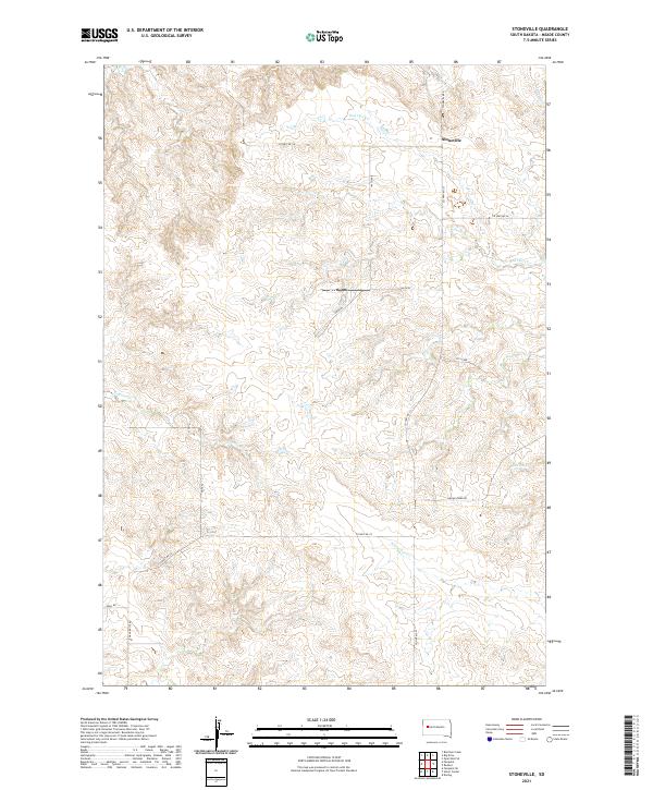
2021 Map of Stoneville
USGS Topo · Published 2021About this map
Stoneville anchors the northern reaches of this Meade County landscape, situated where the high plains meet the headwaters of the regional drainage network. The terrain is defined by a dense system of seasonal waterways, including the winding Red Owl Cr and White Owl Cr, which have shaped the movement and settlement patterns of this ranching country. A grid of rural routes like Stoneville Rd and Chalk Butte Rd provides access to the interior, reflecting a persistent land-use pattern that follows the section lines of Township 9 North and Township 8 North.
Find a feature on this map
19 named features on this map. Tap any name to fly to it.
Don’t see what you’re looking for? This feature index may not catch every label — zoom into the map to look around manually.
Map Details
Editions of this 2021 Stoneville Map
This is the sole edition of this map. No revisions or reprints were ever made.
Other maps of this area

1953 · Rapid City
USGS Topo · 1:250,000

1957 · Rapid City
USGS Topo · 1:250,000

1959 · Fairpoint
USGS Topo · 1:24,000

1959 · Enning
USGS Topo · 1:24,000

1959 · Redowl
USGS Topo · 1:24,000

1959 · Stoneville
USGS Topo · 1:24,000

1959 · Union Center
USGS Topo · 1:24,000
1959 · Fairpoint SE
USGS Topo · 1:24,000

1978 · Bull Run Creek
USGS Topo · 1:24,000

1983 · Opal West SE
USGS Topo · 1:24,000