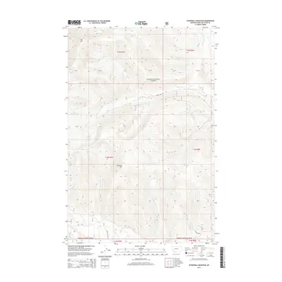
2014 Map of Stonewall Mountain
USGS Topo · Published 2014About this map
Stonewall Mtn and Red Mtn anchor this high-altitude landscape within the Helena National Forest, where a complex drainage network defines the Lewis and Clark County wilderness. This 2014 survey records a remote terrain dominated by glacial features and primitive access routes. High basins hold Upper Copper Lake and Copper Lake, feeding the headwaters of numerous creeks including Copper Cr and Snowbank Cr. The human footprint is confined to a sparse network of forest roads such as Copper Creek Rd and Stonewall Creek Rd, which follow the natural contours of the stream valleys. The map provides a detailed view of the township and range survey lines, such as t15n r9w, cutting through the mountainous interior before these areas were further modified by modern development or large-scale fire events.
Find a feature on this map
33 named features on this map. Tap any name to fly to it.
Don’t see what you’re looking for? This feature index may not catch every label — zoom into the map to look around manually.
Map Details
Editions of this 2014 Stonewall Mountain Map
This is the sole edition of this map. No revisions or reprints were ever made.
Other maps of this area

1889 · Helena
USGS Topo · 1:250,000

1893 · Helena
USGS Topo · 1:250,000

1899 · Helena
USGS Topo · 1:250,000

1903 · Coopers Lake
USGS Topo · 1:125,000

1903 · Helena
USGS Topo · 1:250,000

1947 · Butte
USGS Topo · 1:250,000

1955 · Choteau
USGS Topo · 1:250,000

1957 · Choteau
USGS Topo · 1:250,000

1958 · Butte
USGS Topo · 1:250,000

1958 · Choteau
USGS Topo · 1:250,000