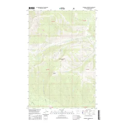
2017 Map of Stonewall Mountain
USGS Topo · Published 2017About this map
Stonewall Mountain and the surrounding peaks of the Helena National Forest define this high-altitude landscape in the Rocky Mountains. The terrain is characterized by a complex network of drainage basins, with waters flowing from the heights of Red Mtn into Ringeye Creek and Red Creek. This 2017 survey details a wilderness where transport is limited to narrow forest corridors like Copper Creek Rd and Stonewall Creek Rd. For those interested in the natural hydrology of the Continental Divide region, the map preserves the exact locations of alpine water bodies including Upper Copper Lake and Copper Lake. Numerous named tributaries, such as Snowbank Creek, Cotter Creek, and Theodore Creek, carve through the steep elevations, illustrating the intricate watershed patterns that feed the larger river systems of Lewis and Clark County.
Find a feature on this map
27 named features on this map. Tap any name to fly to it.
Don’t see what you’re looking for? This feature index may not catch every label — zoom into the map to look around manually.
Map Details
Editions of this 2017 Stonewall Mountain Map
This is the sole edition of this map. No revisions or reprints were ever made.
Other maps of this area

1889 · Helena
USGS Topo · 1:250,000

1893 · Helena
USGS Topo · 1:250,000

1899 · Helena
USGS Topo · 1:250,000

1903 · Coopers Lake
USGS Topo · 1:125,000

1903 · Helena
USGS Topo · 1:250,000

1947 · Butte
USGS Topo · 1:250,000

1955 · Choteau
USGS Topo · 1:250,000

1957 · Choteau
USGS Topo · 1:250,000

1958 · Butte
USGS Topo · 1:250,000

1958 · Choteau
USGS Topo · 1:250,000