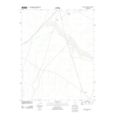
2011 Map of Stonewall Pass
USGS Topo · Published 2011About this map
Stonewall Pass serves as a prominent geographic landmark in this arid portion of Nye County, where the topography transitions through a high desert corridor. The landscape is defined by the braided drainage patterns of Jackson Wash, which carves through the alluvial plains of the Great Basin. This 2011 survey captures the area at a time when transportation infrastructure remained sparse, centered around the Lida Junction Airstrip and the intersection near Forks Station. The spatial arrangement of these features suggests a region primarily used for desert transit and light aviation, with established routes following the natural gradients of the surrounding hills and passes.
Find a feature on this map
4 named features on this map. Tap any name to fly to it.
Don’t see what you’re looking for? This feature index may not catch every label — zoom into the map to look around manually.
Map Details
Editions of this 2011 Stonewall Pass Map
This is the sole edition of this map. No revisions or reprints were ever made.
Other maps of this area

1908 · Lida
USGS Topo · 1:250,000

1913 · Lida
USGS Topo · 1:250,000

1945 · Goldfield
USGS Topo · 1:125,000

1952 · Goldfield
USGS Topo · 1:62,500

1954 · Goldfield
USGS Topo · 1:250,000

1955 · Goldfield
USGS Topo · 1:250,000

1958 · Goldfield
USGS Topo · 1:250,000

1962 · Goldfield
USGS Topo · 1:250,000

1968 · Stonewall Pass
USGS Topo · 1:24,000
1968 · Gold Point
USGS Topo · 1:24,000