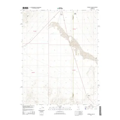
2014 Map of Stonewall Pass
USGS Topo · Published 2014About this map
Stonewall Pass serves as a critical geographic marker in this high desert landscape, positioned where the high ground transitions toward the Lida Valley. The area is defined by the stark topography of the Cuprite Hills to the northwest and the intermittent drainage of Jackson Wash, which carves through the central terrain. This 2014 survey captures a sparsely populated stretch of the Nevada desert straddling the boundary of Esmeralda and Nye counties. Evidence of human infrastructure is concentrated near the north, where Forks Station and the Lida Junction Airport sit along the primary transit corridor. The map reveals the intricate desert pavement and alluvial fans that characterize this portion of the Great Basin, providing a clear record of the area's physical geography and isolated transportation outposts.
Find a feature on this map
11 named features on this map. Tap any name to fly to it.
Don’t see what you’re looking for? This feature index may not catch every label — zoom into the map to look around manually.
Map Details
Editions of this 2014 Stonewall Pass Map
This is the sole edition of this map. No revisions or reprints were ever made.
Other maps of this area

1908 · Lida
USGS Topo · 1:250,000

1913 · Lida
USGS Topo · 1:250,000

1945 · Goldfield
USGS Topo · 1:125,000

1952 · Goldfield
USGS Topo · 1:62,500

1954 · Goldfield
USGS Topo · 1:250,000

1955 · Goldfield
USGS Topo · 1:250,000

1958 · Goldfield
USGS Topo · 1:250,000

1962 · Goldfield
USGS Topo · 1:250,000

1968 · Stonewall Pass
USGS Topo · 1:24,000
1968 · Gold Point
USGS Topo · 1:24,000