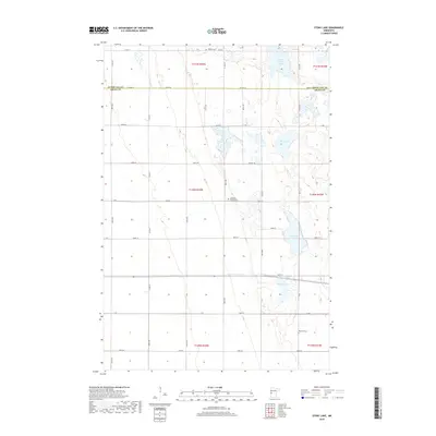
2019 Map of Stony Lake
USGS Topo · Published 2019About this map
Rabbit River meanders through the western reaches of this agricultural landscape at the border of Otter Tail and Grant counties. The region is defined by its glacial hydrology, with a significant concentration of water bodies including Stony Lake, Ash Lake, and Upper Lightning Lake clustered in the central and eastern sections. This survey provides a clear view of the rural infrastructure at the turn of the decade, where long-established community landmarks continue to anchor the township. Family researchers will find several points of interest along the section lines, notably the Lawrence Presbyterian Church and its associated Lawrence Cem, alongside the Western Cem to the north and Hereford Cem near the southern boundary. The grid of county highways and township roads, such as Co Hwy 26 and Co Hwy 18, reveals the enduring spatial organization of this prairie-pothole territory.
Find a feature on this map
38 named features on this map. Tap any name to fly to it.
Don’t see what you’re looking for? This feature index may not catch every label — zoom into the map to look around manually.
Map Details
Editions of this 2019 Stony Lake Map
This is the sole edition of this map. No revisions or reprints were ever made.
Other maps of this area

1910 · Wendell
USGS Topo · 1:62,500

1911 · Herman
USGS Topo · 1:62,500

1913 · Wendell
USGS Topo · 1:62,500

1951 · Wheaton
USGS Topo · 1:62,500

1951 · Campbell
USGS Topo · 1:62,500

1953 · Milbank
USGS Topo · 1:250,000

1953 · Fargo
USGS Topo · 1:250,000

1956 · Fargo
USGS Topo · 1:250,000

1958 · Milbank
USGS Topo · 1:250,000

1973 · Herman NW
USGS Topo · 1:24,000