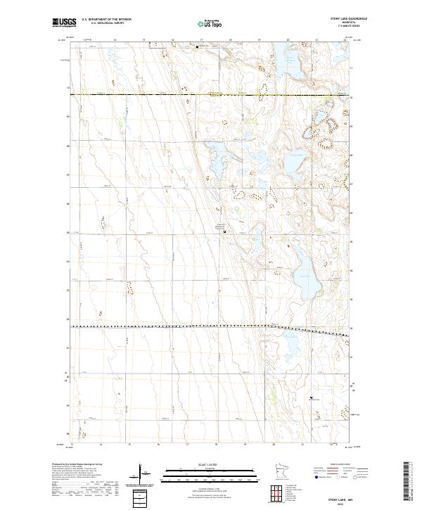
2022 Map of Stony Lake
USGS Topo · Published 2022About this map
The Otter Tail and Grant County line bisects this agricultural landscape, where the prairie gives way to a complex network of glacial wetlands and lakes. The central portion of the sheet is anchored by the Lawrence Presbyterian Church and the adjacent Lawrence Presbyterian Church Cem, marking a long-standing community center for local farming families. Nearby, the waters of Stony Lake and Ash Lake define the terrain, fed by the winding course of the Rabbit River as it moves through the western sections.
Find a feature on this map
36 named features on this map. Tap any name to fly to it.
Don’t see what you’re looking for? This feature index may not catch every label — zoom into the map to look around manually.
Map Details
Editions of this 2022 Stony Lake Map
This is the sole edition of this map. No revisions or reprints were ever made.
Other maps of this area

1910 · Wendell
USGS Topo · 1:62,500

1911 · Herman
USGS Topo · 1:62,500

1913 · Wendell
USGS Topo · 1:62,500

1951 · Wheaton
USGS Topo · 1:62,500

1951 · Campbell
USGS Topo · 1:62,500

1953 · Milbank
USGS Topo · 1:250,000

1953 · Fargo
USGS Topo · 1:250,000

1956 · Fargo
USGS Topo · 1:250,000

1958 · Milbank
USGS Topo · 1:250,000

1973 · Herman NW
USGS Topo · 1:24,000