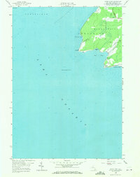
1958 Map of Stony Point
USGS Topo · Published 1971About this map
Stony Point dominates this shoreline where the townships of Henderson and Hounsfield meet. The 1950s landscape is defined by its maritime infrastructure and a network of rural routes, including the prominent Military Road and Carter Road. Navigational safety is marked by a Lighthouse perched on the western edge of the point, overlooking the deep waters of Lake Ontario. The jagged coast reveals a succession of sheltered waters such as Gravely Bay, Boomer Cove, and Ray Bay, which separate the mainland from features like Clark Point. This survey captures the area's transition from the open lake to the dense terrain of Jefferson County, providing an exact look at the road systems and shoreline before later development. The inclusion of Calf Island to the north and the soundings throughout the bays offer a precise view of the coastal topography as it existed in the mid-20th century.
Find a feature on this map
18 named features on this map. Tap any name to fly to it.
Don’t see what you’re looking for? This feature index may not catch every label — zoom into the map to look around manually.
Map Details
Editions of this 1958 Stony Point Map
2 editions found
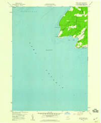
Other maps of this area

1893 · Sackets Harbor
USGS Topo · 1:62,500

1895 · Sacketts Harbor
USGS Topo · 1:62,500

1895 · Stony Island
USGS Topo · 1:62,500

1895 · Pulaski
USGS Topo · 1:62,500

1942 · Stony Point
USGS Topo · 1:31,680

1942 · Henderson Bay
USGS Topo · 1:31,680

1942 · Galloo Island
USGS Topo · 1:31,680

1942 · Point Peninsula
USGS Topo · 1:31,680

1943 · Henderson
USGS Topo · 1:31,680
1943 · Ellisburg
USGS Topo · 1:31,680