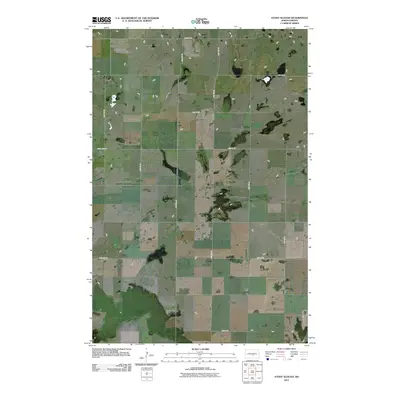
2011 Map of Stony Slough
USGS Topo · Published 2011About this map
Agricultural prairie lands in Burleigh County define this landscape as it appeared in the early 21st century. The map shows a strict section-line grid of rural roads and section borders, illustrating the enduring influence of the Public Land Survey System on North Dakota's topography. Primary transit corridors like 29th St SE and 20th Ave SE provide the framework for the area's sparse rural development. Occasional wetlands and small water bodies punctuate the plains, most notably near the intersection of 31st St SE and 19th Ave SE. The boundary line between the MT and MS townships runs through the center of the quadrangle, serving as a key reference point for local history and land ownership research.
Find a feature on this map
15 named features on this map. Tap any name to fly to it.
Don’t see what you’re looking for? This feature index may not catch every label — zoom into the map to look around manually.
Map Details
Editions of this 2011 Stony Slough Map
This is the sole edition of this map. No revisions or reprints were ever made.
Other maps of this area

1951 · Driscoll
USGS Topo · 1:62,500

1952 · Steele
USGS Topo · 1:24,000

1952 · Steele NW
USGS Topo · 1:24,000

1952 · New Rockford
USGS Topo · 1:250,000

1953 · Jamestown
USGS Topo · 1:250,000

1954 · Bismarck
USGS Topo · 1:250,000

1954 · McClusky
USGS Topo · 1:250,000

1956 · New Rockford
USGS Topo · 1:250,000

1956 · Jamestown
USGS Topo · 1:250,000

1958 · Bismarck
USGS Topo · 1:250,000