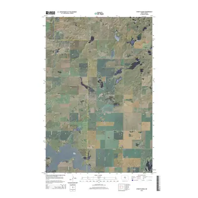
2014 Map of Stony Slough
USGS Topo · Published 2014About this map
Stony Slough defines the low-lying prairie landscape of this region, which sits along the intersection of the Kidder Co and Burleigh Co borders. In the early 21st century, the terrain remains organized by an extensive grid of section-line roads, such as 175th Ave NE and 30th St SE, which facilitate travel through this largely agricultural environment. The drainage patterns and localized depressions visible across the sheet are characteristic of the pothole region, where seasonal waters collect in shallow basins. The map illustrates a rural area where the primary human footprint is the meticulous road network, indicating a landscape where land management and travel follow the rigid geometry of the Public Land Survey System. Researchers can observe how contemporary transportation routes, including 110th Ave NE, navigate around the wetland features that dot the county line.
Find a feature on this map
18 named features on this map. Tap any name to fly to it.
Don’t see what you’re looking for? This feature index may not catch every label — zoom into the map to look around manually.
Map Details
Editions of this 2014 Stony Slough Map
This is the sole edition of this map. No revisions or reprints were ever made.
Other maps of this area

1951 · Driscoll
USGS Topo · 1:62,500

1952 · Steele
USGS Topo · 1:24,000

1952 · Steele NW
USGS Topo · 1:24,000

1952 · New Rockford
USGS Topo · 1:250,000

1953 · Jamestown
USGS Topo · 1:250,000

1954 · Bismarck
USGS Topo · 1:250,000

1954 · McClusky
USGS Topo · 1:250,000

1956 · New Rockford
USGS Topo · 1:250,000

1956 · Jamestown
USGS Topo · 1:250,000

1958 · Bismarck
USGS Topo · 1:250,000