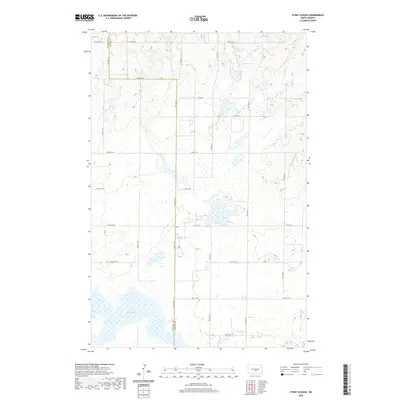
2020 Map of Stony Slough
USGS Topo · Published 2020About this map
Stony Slough defines the hydrologic character of this prairie landscape along the border of Burleigh and Kidder Counties. The terrain is marked by a complex network of wetlands and small water bodies that dictate the positioning of the local section-line road system. This grid of county roads, including 175th Ave NE, 162nd Ave NE, and 110th Ave NE, provides the primary structure for the rural agricultural tracts. The map illustrates the persistent intersection of the Public Land Survey System with natural water features, where township lines like t140n r75w and t140n r74w cross the seasonally variable sloughs typical of this portion of North Dakota.
Find a feature on this map
23 named features on this map. Tap any name to fly to it.
Don’t see what you’re looking for? This feature index may not catch every label — zoom into the map to look around manually.
Map Details
Editions of this 2020 Stony Slough Map
This is the sole edition of this map. No revisions or reprints were ever made.
Other maps of this area

1951 · Driscoll
USGS Topo · 1:62,500

1952 · Steele
USGS Topo · 1:24,000

1952 · Steele NW
USGS Topo · 1:24,000

1952 · New Rockford
USGS Topo · 1:250,000

1953 · Jamestown
USGS Topo · 1:250,000

1954 · Bismarck
USGS Topo · 1:250,000

1954 · McClusky
USGS Topo · 1:250,000

1956 · New Rockford
USGS Topo · 1:250,000

1956 · Jamestown
USGS Topo · 1:250,000

1958 · Bismarck
USGS Topo · 1:250,000