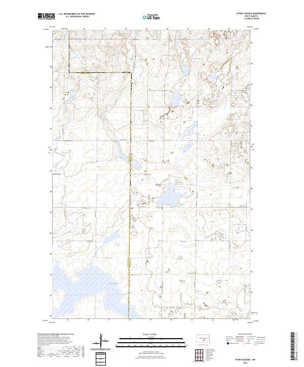
2024 Map of Stony Slough
USGS Topo · Published 2024About this map
The boundary line between Kidder Co and Burleigh Co bisects this landscape of glacial wetlands and prairie potholes. The namesake Stony Slough dominates the southern reaches, where seasonally flooded depressions create a complex network of water bodies. This area is essential habitat for migratory birds, as evidenced by the large Burleigh County Waterfowl Production Area positioned at the center of the sheet. The terrain is defined by a systematic grid of section lines and gravel roads, including 36th St SE and 110th Ave NE, which provide access to the remote agricultural and conservation lands. The map illustrates a contemporary view of the northern Great Plains, where land management for wildlife conservation exists alongside traditional township and range divisions.
Find a feature on this map
25 named features on this map. Tap any name to fly to it.
Don’t see what you’re looking for? This feature index may not catch every label — zoom into the map to look around manually.
Map Details
Editions of this 2024 Stony Slough Map
This is the sole edition of this map. No revisions or reprints were ever made.
Other maps of this area

1951 · Driscoll
USGS Topo · 1:62,500

1952 · Steele
USGS Topo · 1:24,000

1952 · Steele NW
USGS Topo · 1:24,000

1952 · New Rockford
USGS Topo · 1:250,000

1953 · Jamestown
USGS Topo · 1:250,000

1954 · Bismarck
USGS Topo · 1:250,000

1954 · McClusky
USGS Topo · 1:250,000

1956 · New Rockford
USGS Topo · 1:250,000

1956 · Jamestown
USGS Topo · 1:250,000

1958 · Bismarck
USGS Topo · 1:250,000