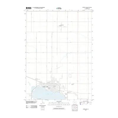
2010 Map of Storm Lake
USGS Topo · Published 2010About this map
Storm Lake anchors this Buena Vista County landscape, where the city of the same name meets the water at Casino Beach. The urban footprint is clearly defined by a grid of numbered avenues and streets, containing key local institutions such as Buena Vista University and the Storm Lake Post Office. To the north, the small settlement of Truesdale remains a distinct community centered around the Truesdale Post Office and a network of rural roads like County Rd and Co Rd M44. Several burial sites, including Saint Marys Cemetery and Storm Lake Municipal Cemetery, provide significant points of interest for genealogists tracing local families. The surrounding agricultural land is drained by several small watercourses, most notably the meandering Poor Farm Creek and Brooke Creek, illustrating the intersection of residential growth and the traditional Iowa prairie landscape.
Find a feature on this map
37 named features on this map. Tap any name to fly to it.
Don’t see what you’re looking for? This feature index may not catch every label — zoom into the map to look around manually.
Map Details
Editions of this 2010 Storm Lake Map
This is the sole edition of this map. No revisions or reprints were ever made.
Other maps of this area

1954 · Fort Dodge
USGS Topo · 1:250,000

1957 · Fort Dodge
USGS Topo · 1:250,000

1958 · Fort Dodge
USGS Topo · 1:250,000

1971 · Sioux Rapids SE
USGS Topo · 1:24,000

1971 · Rembrandt
USGS Topo · 1:24,000

1971 · Peterson SE
USGS Topo · 1:24,000

1979 · Lakeside
USGS Topo · 1:24,000

1979 · Storm Lake
USGS Topo · 1:24,000

1979 · Newell West
USGS Topo · 1:24,000

1979 · Alta
USGS Topo · 1:24,000