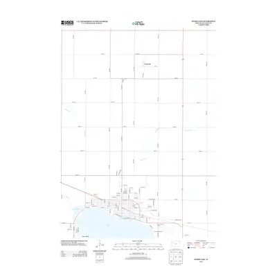
2013 Map of Storm Lake
USGS Topo · Published 2013About this map
Storm Lake and its smaller neighbor, Little Storm Lake, anchor the southern half of this landscape, where the city grid meets the water's edge. The northern expanse is defined by a rigorous agricultural section-line road network, including 540th St and 550th St, which connects the small settlement of Truesdale to the surrounding farms. Along the northern shore of the main lake, residential developments and recreational spaces like the Storm Lake Golf Course and Sunrise Campgrounds highlight the area's dual role as both a regional hub and a destination. Several drainage systems, most notably Poor Farm Creek and Brooke Creek, wind through the gently undulating terrain, showing how the natural hydrology interacts with the established road grid. Near the southwestern shoreline, Casino Beach sits as a distinct lakeside locality just west of the main urban center.
Find a feature on this map
81 named features on this map. Tap any name to fly to it.
Don’t see what you’re looking for? This feature index may not catch every label — zoom into the map to look around manually.
Map Details
Editions of this 2013 Storm Lake Map
This is the sole edition of this map. No revisions or reprints were ever made.
Other maps of this area

1954 · Fort Dodge
USGS Topo · 1:250,000

1957 · Fort Dodge
USGS Topo · 1:250,000

1958 · Fort Dodge
USGS Topo · 1:250,000

1971 · Sioux Rapids SE
USGS Topo · 1:24,000

1971 · Rembrandt
USGS Topo · 1:24,000

1971 · Peterson SE
USGS Topo · 1:24,000

1979 · Lakeside
USGS Topo · 1:24,000

1979 · Storm Lake
USGS Topo · 1:24,000

1979 · Newell West
USGS Topo · 1:24,000

1979 · Alta
USGS Topo · 1:24,000