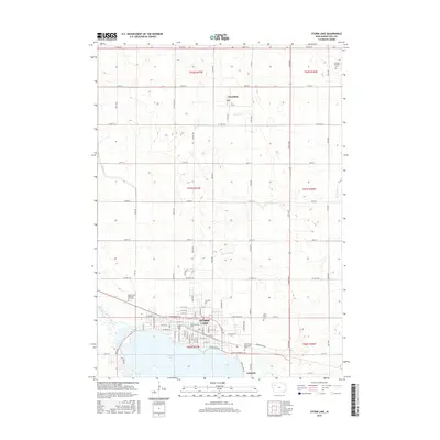
2015 Map of Storm Lake
USGS Topo · Published 2015About this map
Storm Lake dominates the southern portion of this landscape, its northern shoreline defined by the growth of the city of Storm Lake. The campus of Buena Vista University sits along the lakefront, while the smaller community of Lakeside occupies the southeastern shore. To the north, the land transitions into a strictly surveyed grid of agricultural sections, punctuated by the town of Truesdale. This drainage pattern is shaped by slow-moving waterways such as Poor Farm Creek, Brooke Creek, and Powell Creek, which navigate the slight variations in elevation across the prairie. The map provides a detailed view of the regional infrastructure including Capps Memorial Freeway and several local burial grounds such as Lincoln Township Cemetery and Saint Mary's Cemetery, reflecting the area's established rural and civic history.
Find a feature on this map
33 named features on this map. Tap any name to fly to it.
Don’t see what you’re looking for? This feature index may not catch every label — zoom into the map to look around manually.
Map Details
Editions of this 2015 Storm Lake Map
This is the sole edition of this map. No revisions or reprints were ever made.
Other maps of this area

1954 · Fort Dodge
USGS Topo · 1:250,000

1957 · Fort Dodge
USGS Topo · 1:250,000

1958 · Fort Dodge
USGS Topo · 1:250,000

1971 · Sioux Rapids SE
USGS Topo · 1:24,000

1971 · Rembrandt
USGS Topo · 1:24,000

1971 · Peterson SE
USGS Topo · 1:24,000

1979 · Lakeside
USGS Topo · 1:24,000

1979 · Storm Lake
USGS Topo · 1:24,000

1979 · Newell West
USGS Topo · 1:24,000

1979 · Alta
USGS Topo · 1:24,000