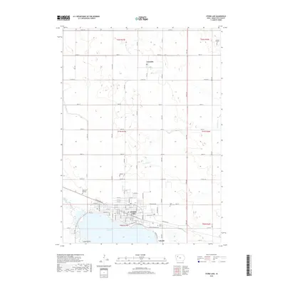
2018 Map of Storm Lake
USGS Topo · Published 2018About this map
Storm Lake dominates the southern portion of this Buena Vista County landscape, serving as the focal point for the city of Storm Lake and its neighboring communities. Along the northern shoreline, the city's street grid extends toward Lakeside and the recreational area of Casino Beach, while several local cemeteries, including Buena Vista Memorial Park Cem and Saint Mary's Cem, sit on the outskirts of the town center. To the north, the small settlement of Truesdale is surrounded by a vast grid of section lines and rural roads such as Co Hwy C43. This survey illustrates the relationship between the glacial lake and the agricultural landscape of Northwest Iowa, where watercourses like Poor Farm Cr and Brooke Cr meander through the prairie sections. The map records the local infrastructure as of 2018, from Capps Memorial Fwy to the remote Lincoln Township Cem in the northeast.
Find a feature on this map
31 named features on this map. Tap any name to fly to it.
Don’t see what you’re looking for? This feature index may not catch every label — zoom into the map to look around manually.
Map Details
Editions of this 2018 Storm Lake Map
This is the sole edition of this map. No revisions or reprints were ever made.
Other maps of this area

1954 · Fort Dodge
USGS Topo · 1:250,000

1957 · Fort Dodge
USGS Topo · 1:250,000

1958 · Fort Dodge
USGS Topo · 1:250,000

1971 · Sioux Rapids SE
USGS Topo · 1:24,000

1971 · Rembrandt
USGS Topo · 1:24,000

1971 · Peterson SE
USGS Topo · 1:24,000

1979 · Lakeside
USGS Topo · 1:24,000

1979 · Storm Lake
USGS Topo · 1:24,000

1979 · Newell West
USGS Topo · 1:24,000

1979 · Alta
USGS Topo · 1:24,000