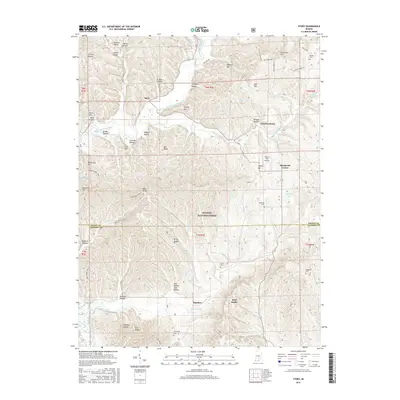
2016 Map of Story
USGS Topo · Published 2016About this map
Story and Christiansburg sit as quiet rural anchors in this pocket of southern Indiana, where the terrain is defined by a dense network of hollows and ridges. The landscape transitions from the agricultural flats along Middle Fork Salt Creek to the protected woodlands of the Hoosier National Forest. Evidence of early settlement is preserved in the numerous family-named landmarks and cemeteries, including Moffitt Cem and Lutes Cem. The map reveals a remote geography where deep valleys like Harrison Hollow and Freeze Hollow separate high points such as Oak Ridge and Bald Knobs. Outdoor recreation and historical routes are prominent, particularly the Nebo Ridge Trail 1 which winds through the southern ridges. Small settlements like Spurgeons Corner and Houston mark the crossroads of a community historically tied to the timber and topography of the Brown and Jackson county line.
Find a feature on this map
69 named features on this map. Tap any name to fly to it.
Don’t see what you’re looking for? This feature index may not catch every label — zoom into the map to look around manually.
Map Details
Editions of this 2016 Story Map
This is the sole edition of this map. No revisions or reprints were ever made.
Other maps of this area

1934 · Bedford
USGS Topo · 1:48,000

1937 · Bedford
USGS Topo · 1:62,500

1942 · Franklin
USGS Topo · 1:125,000

1946 · Belmont
USGS Topo · 1:24,000

1947 · Nashville
USGS Topo · 1:24,000

1947 · Elkinsville
USGS Topo · 1:24,000

1948 · New Bellsville
USGS Topo · 1:24,000

1948 · Waymansville
USGS Topo · 1:24,000

1949 · Nashville
USGS Topo · 1:24,000

1950 · Belmont
USGS Topo · 1:24,000