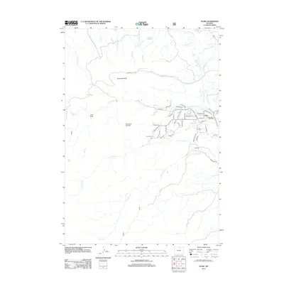
2012 Map of Story
USGS Topo · Published 2012About this map
Story stands as the primary settlement on this landscape, characterized by a complex network of residential lanes such as Ponderosa Dr and Rosebud Ln east of Grandmas Mountain. The area’s agricultural and water management history is etched into the terrain through a system of irrigation canals, including the Meade Coffeen Ditch and the Big Piney Divide Ditch, which redirect the flow of numerous local waterways. Notable landmarks like Wagon Box and the Kgk Tower punctuate the lower elevations, while the higher ground is defined by Moncreiffe Ridge and Long Draw. The presence of the Stockwell Pack Trl indicates established routes through the upland areas north of North Piney Creek, serving as a record of early transportation patterns that predate the modern road grid.
Find a feature on this map
60 named features on this map. Tap any name to fly to it.
Don’t see what you’re looking for? This feature index may not catch every label — zoom into the map to look around manually.
Map Details
Editions of this 2012 Story Map
This is the sole edition of this map. No revisions or reprints were ever made.
Other maps of this area

1895 · Dayton
USGS Topo · 1:125,000

1899 · Cloud peak
USGS Topo · 1:125,000

1900 · Fort McKinney
USGS Topo · 1:125,000

1901 · Cloud Peak
USGS Topo · 1:125,000

1901 · Dayton
USGS Topo · 1:125,000

1903 · Fort McKinney
USGS Topo · 1:125,000

1909 · Sheridan
USGS Topo · 1:125,000

1911 · Sheridan
USGS Topo · 1:125,000

1955 · Sheridan
USGS Topo · 1:250,000

1958 · Sheridan
USGS Topo · 1:250,000