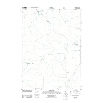
2011 Map of Story
USGS Topo · Published 2011About this map
Story sits at the intersection of Story Rd and a network of ephemeral waterways that define this corner of Sioux County. The landscape is characterized by the ranching heritage of western Nebraska, where family-named landmarks like Wallace Ranch, Locker Ranch, and Falkenburg Ranch anchor the remote terrain. Water management is central to life here, evidenced by numerous small-scale impoundments including Anderson Reservoir and Schnurr Reservoir Number 2. A intricate drainage system consisting of North Antelope Creek, South Antelope Creek, and Squaw Creek carves through the plains, while uniquely named topographic features such as Grandma Davis Draw reflect a long-standing local connection to the land and its specific family histories.
Find a feature on this map
22 named features on this map. Tap any name to fly to it.
Don’t see what you’re looking for? This feature index may not catch every label — zoom into the map to look around manually.
Map Details
Editions of this 2011 Story Map
This is the sole edition of this map. No revisions or reprints were ever made.
Other maps of this area

1902 · Edgemont
USGS Topo · 1:125,000

1954 · Torrington
USGS Topo · 1:250,000

1955 · Hot Springs
USGS Topo · 1:250,000

1955 · Newcastle
USGS Topo · 1:250,000

1955 · Alliance
USGS Topo · 1:250,000

1957 · Alliance
USGS Topo · 1:250,000

1958 · Torrington
USGS Topo · 1:250,000

1958 · Alliance
USGS Topo · 1:250,000

1958 · Newcastle
USGS Topo · 1:250,000
1978 · Oat Creek
USGS Topo · 1:24,000