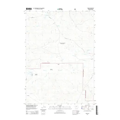
2014 Map of Story
USGS Topo · Published 2014About this map
The settlement of Story anchors this high plains landscape within the Oglala National Grassland of Sioux County. This region is defined by a sparse but vital water network, where numerous small reservoirs like Hay Cr Wallace Reservoir, Wallace Reservoir, and Anderson Reservoir are situated to capture runoff in a semi-arid environment. The drainage patterns are clearly delineated, showing how Indian Cr and Squaw Cr navigate the dissected terrain. A distinctive local landmark, Grandma Davis Draw, cuts through the center of the sheet, providing a specific named reference point for genealogical or local historical research. The presence of these named reservoirs and draws indicates a landscape deeply managed for ranching and livestock, where every topographical depression and water source was of critical importance to the local inhabitants and land managers.
Find a feature on this map
17 named features on this map. Tap any name to fly to it.
Don’t see what you’re looking for? This feature index may not catch every label — zoom into the map to look around manually.
Map Details
Editions of this 2014 Story Map
This is the sole edition of this map. No revisions or reprints were ever made.
Other maps of this area

1902 · Edgemont
USGS Topo · 1:125,000

1954 · Torrington
USGS Topo · 1:250,000

1955 · Hot Springs
USGS Topo · 1:250,000

1955 · Newcastle
USGS Topo · 1:250,000

1955 · Alliance
USGS Topo · 1:250,000

1957 · Alliance
USGS Topo · 1:250,000

1958 · Torrington
USGS Topo · 1:250,000

1958 · Alliance
USGS Topo · 1:250,000

1958 · Newcastle
USGS Topo · 1:250,000
1978 · Oat Creek
USGS Topo · 1:24,000