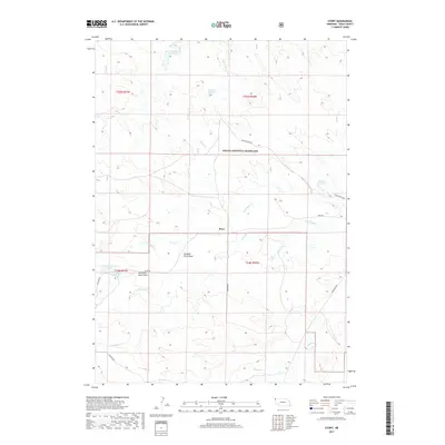
2017 Map of Story
USGS Topo · Published 2017About this map
Story sits at the heart of this high plains landscape within Sioux County, Nebraska, where the drainage patterns of N Antelope Cr and S Antelope Cr shape the local topography. This 2017 survey details a region dominated by the Oglala National Grassland, reflecting a land-use history centered on grazing and water management. The map identifies several vital water resources, including the Wallace Reservoir and Anderson Reservoir, which are critical in this arid environment. Distinctive local names such as Grandma Davis Draw provide a link to the families and individuals who settled and worked these lands. The infrastructure of the area is defined by gravel routes like Story Rd and Schnurr Rd, which connect isolated ranching sites and public lands, illustrating the vast, open character of the Nebraska panhandle in the early 21st century.
Find a feature on this map
20 named features on this map. Tap any name to fly to it.
Don’t see what you’re looking for? This feature index may not catch every label — zoom into the map to look around manually.
Map Details
Editions of this 2017 Story Map
This is the sole edition of this map. No revisions or reprints were ever made.
Other maps of this area

1902 · Edgemont
USGS Topo · 1:125,000

1954 · Torrington
USGS Topo · 1:250,000

1955 · Hot Springs
USGS Topo · 1:250,000

1955 · Newcastle
USGS Topo · 1:250,000

1955 · Alliance
USGS Topo · 1:250,000

1957 · Alliance
USGS Topo · 1:250,000

1958 · Torrington
USGS Topo · 1:250,000

1958 · Alliance
USGS Topo · 1:250,000

1958 · Newcastle
USGS Topo · 1:250,000
1978 · Oat Creek
USGS Topo · 1:24,000