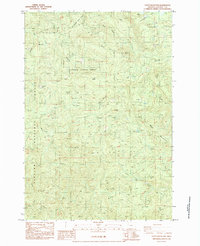
1984 Map of Stott Mountain
USGS Topo · Published 1984About this map
Siuslaw National Forest dominates this mid-1980s landscape in Lincoln County, where the terrain is defined by the high ridges of Stott Mountain and Bald Mountain. The map serves as a detailed record of the timber-and-stream geography of the Oregon Coast Range, highlighting an extensive network of 4WD trails and forest service access points. Local historical sites, such as the Minski Place and Horner Ranch, appear as former settlements or landmarks rather than active towns, suggesting the area's shift toward conservation and resource management.
Find a feature on this map
41 named features on this map. Tap any name to fly to it.
Don’t see what you’re looking for? This feature index may not catch every label — zoom into the map to look around manually.
Map Details
Editions of this 1984 Stott Mountain Map
This is the sole edition of this map. No revisions or reprints were ever made.
Other maps of this area

1941 · Nestucca Bay
USGS Topo · 1:62,500

1942 · Euchre Mtn
USGS Topo · 1:62,500

1942 · Spirit Mtn
USGS Topo · 1:62,500

1942 · Nestucca Bay
USGS Topo · 1:62,500

1942 · Valsetz
USGS Topo · 1:62,500

1943 · Euchre Mtn
USGS Topo · 1:62,500

1948 · Vancouver
USGS Topo · 1:250,000

1950 · Vancouver
USGS Topo · 1:250,000

1950 · Vancouver
USGS Topo · 1:250,000

1953 · Salem
USGS Topo · 1:250,000