
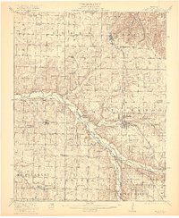
1921 Map of Stotts City
USGS Topo · Published 1921About this map
Spring River meanders across the Missouri landscape, carving a valley through the townships of Vineyard and Mount Vernon. This 1921 survey reveals a region defined by agricultural organization and early 20th-century social infrastructure. Concentrated around the county seat of Mt Vernon, landmarks like the State Sanitarium and the County Farm denote the public institutions of the era. The mapping of countless rural schools, such as the Spanish Fort School and Blue Hall School, indicates a densely settled countryside where local education was the cornerstone of community life.
Find a feature on this map
66 named features on this map. Tap any name to fly to it.
Don’t see what you’re looking for? This feature index may not catch every label — zoom into the map to look around manually.
Map Details
Editions of this 1921 Stotts City Map
2 editions found
Other maps of this area

1886 · Greenfield
USGS Topo · 1:125,000

1886 · Carthage
USGS Topo · 1:125,000

1888 · Greenfield
USGS Topo · 1:125,000

1894 · Carthage
USGS Topo · 1:125,000

1919 · Halltown
USGS Topo · 1:62,500

1921 · Sarcoxie
USGS Topo · 1:62,500

1942 · Aurora
USGS Topo · 1:62,500

1943 · Ritchey
USGS Topo · 1:62,500

1943 · Monett
USGS Topo · 1:62,500

1945 · Harrison
USGS Topo · 1:250,000