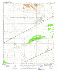
1950 Map of Stoval
USGS Topo · Published 1966About this map
The Southern Pacific railroad corridor serves as the primary axis of development across the San Cristobal Valley in this mid-century desert study. Small rail-side outposts like Stoval, Horn, and Kofa Sta anchor the transport network against the backdrop of the Palomas Mountains. A significant military presence is evident in the Fort Horn Mil Res (Abandoned), which includes a visible landing strip and grid-style camp layout north of the tracks.
Find a feature on this map
24 named features on this map. Tap any name to fly to it.
Don’t see what you’re looking for? This feature index may not catch every label — zoom into the map to look around manually.
Map Details
Editions of this 1950 Stoval Map
2 editions found

Other maps of this area

1926 · Mohawk
USGS Topo · 1:62,500

1927 · Aguila Mountains
USGS Topo · 1:48,000

1927 · Kim
USGS Topo · 1:62,500

1927 · Hyder
USGS Topo · 1:62,500

1928 · Mohawk
USGS Topo · 1:62,500

1928 · Norton
USGS Topo · 1:62,500

1929 · Aztec
USGS Topo · 1:62,500

1929 · Norton
USGS Topo · 1:62,500

1930 · Aguila Mountains
USGS Topo · 1:62,500

1930 · Stoval
USGS Topo · 1:62,500