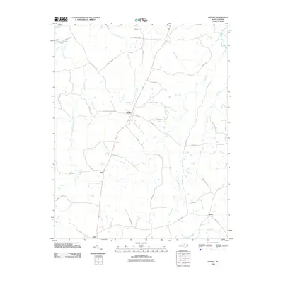
2010 Map of Stovall
USGS Topo · Published 2010About this map
Stovall serves as the central hub of this northern Granville County landscape, where the road network radiates outward toward smaller rural communities like Bullock to the north and Gela to the southwest. The terrain is defined by a dense network of waterways including Spewmarrow Creek and Grassy Creek, which suggest the agricultural history of the region. Family names and local legacies are preserved through features like Royster Cemetery and numerous family-named roads, providing essential data for genealogists tracing ancestral landholdings. In the eastern portion of the map, Buckhorn Springs and the headwaters of Michael Creek mark the transition toward the community of Dexter. This 2010 survey offers a detailed view of the modern rural infrastructure and natural drainage patterns that have shaped this portion of North Carolina for generations.
Find a feature on this map
53 named features on this map. Tap any name to fly to it.
Don’t see what you’re looking for? This feature index may not catch every label — zoom into the map to look around manually.
Map Details
Editions of this 2010 Stovall Map
This is the sole edition of this map. No revisions or reprints were ever made.
Other maps of this area

1941 · Clarksville
USGS Topo · 1:48,000

1943 · Clarksville
USGS Topo · 1:62,500

1953 · Oxford
USGS Topo · 1:62,500

1953 · Greensboro
USGS Topo · 1:250,000

1954 · Greensboro
USGS Topo · 1:250,000

1955 · Boydton
USGS Topo · 1:62,500

1957 · Clarksville
USGS Topo · 1:62,500

1962 · Greensboro
USGS Topo · 1:250,000

1966 · Greensboro
USGS Topo · 1:250,000

1966 · Oxford
USGS Topo · 1:62,500