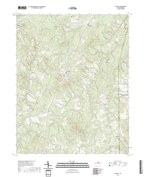
2022 Map of Stovall
USGS Topo · Published 2022About this map
John Penns Grave and the northern reaches of Granville County anchor this modern mapping of the North Carolina borderlands. The town of Stovall sits as a central hub, where the RR line parallels Railroad St, serving as a legacy of the area's transit history. To the north, the small community of Bullock and the waters of Spewmarrow Cr define the landscape leading toward the Virginia state line.
Find a feature on this map
87 named features on this map. Tap any name to fly to it.
Don’t see what you’re looking for? This feature index may not catch every label — zoom into the map to look around manually.
Map Details
Editions of this 2022 Stovall Map
This is the sole edition of this map. No revisions or reprints were ever made.
Other maps of this area

1941 · Clarksville
USGS Topo · 1:48,000

1943 · Clarksville
USGS Topo · 1:62,500

1953 · Oxford
USGS Topo · 1:62,500

1953 · Greensboro
USGS Topo · 1:250,000

1954 · Greensboro
USGS Topo · 1:250,000

1955 · Boydton
USGS Topo · 1:62,500

1957 · Clarksville
USGS Topo · 1:62,500

1962 · Greensboro
USGS Topo · 1:250,000

1966 · Greensboro
USGS Topo · 1:250,000

1966 · Oxford
USGS Topo · 1:62,500