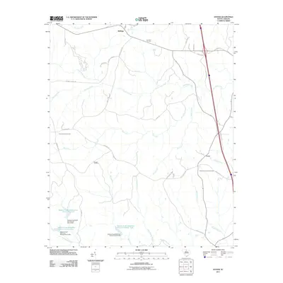
2011 Map of Stover
USGS Topo · Published 2011About this map
The small settlement of Wellridge anchors the northern reaches of this Chester County landscape, where the rural character is defined by a dense network of watercourses and family-named homesteads. The terrain is bisected by the Little Rocky Creek and Stover Creek systems, which flow toward larger water management projects in the south. Significant hydrological engineering is visible through the Wateree Creek Conservation District Reservoir and a series of numbered watershed structures, including Wateree Creek Watershed Structure Number Two and Number Three. These features reflect modern agricultural and flood control efforts in the Piedmont region. For those researching local history, several burial grounds are scattered throughout the area, such as the Gold Mine Cemetery and Richmond Covenanter Cemetery near the community of Stover, providing valuable points of reference for genealogical study along old roads like Hopewell Church Rd and McDonalds Farm.
Find a feature on this map
43 named features on this map. Tap any name to fly to it.
Don’t see what you’re looking for? This feature index may not catch every label — zoom into the map to look around manually.
Map Details
Editions of this 2011 Stover Map
This is the sole edition of this map. No revisions or reprints were ever made.
Other maps of this area

1904 · Columbia
USGS Topo · 1:125,000

1941 · Spartanburg
USGS Topo · 1:250,000

1942 · Camden
USGS Topo · 1:125,000

1953 · Spartanburg
USGS Topo · 1:250,000

1960 · Spartanburg
USGS Topo · 1:250,000

1963 · Spartanburg
USGS Topo · 1:250,000

1964 · Spartanburg
USGS Topo · 1:250,000

1968 · Blackstock
USGS Topo · 1:24,000
1969 · Fort Lawn
USGS Topo · 1:24,000
1969 · Great Falls
USGS Topo · 1:24,000