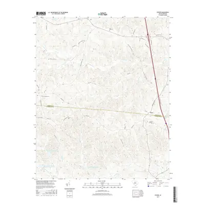
2017 Map of Stover
USGS Topo · Published 2017About this map
Stover sits at the intersection of the Chester Co and Fairfield Co border, serving as a focal point for this rural South Carolina landscape. The terrain is defined by an intricate network of waterways, including the winding path of Big Wateree Creek and its various tributaries such as Woodward Br and Willow Swamp Br. These streams cut through the land, shaping the local topography and historical settlement patterns that follow the ridges between drainage basins.
Find a feature on this map
45 named features on this map. Tap any name to fly to it.
Don’t see what you’re looking for? This feature index may not catch every label — zoom into the map to look around manually.
Map Details
Editions of this 2017 Stover Map
This is the sole edition of this map. No revisions or reprints were ever made.
Other maps of this area

1904 · Columbia
USGS Topo · 1:125,000

1941 · Spartanburg
USGS Topo · 1:250,000

1942 · Camden
USGS Topo · 1:125,000

1953 · Spartanburg
USGS Topo · 1:250,000

1960 · Spartanburg
USGS Topo · 1:250,000

1963 · Spartanburg
USGS Topo · 1:250,000

1964 · Spartanburg
USGS Topo · 1:250,000

1968 · Blackstock
USGS Topo · 1:24,000
1969 · Fort Lawn
USGS Topo · 1:24,000
1969 · Great Falls
USGS Topo · 1:24,000