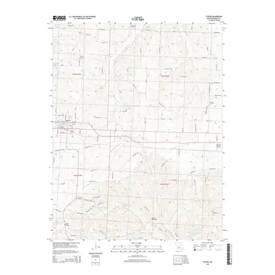
2015 Map of Stover
USGS Topo · Published 2015About this map
Stover serves as the central hub of this Missouri landscape, where the local road network radiates from the town center into the surrounding rural townships of Morgan County. The terrain is defined by the winding paths of Middle Richland Cr and Richland Cr, which carve through the countryside alongside the distinctive ridge known as Devils Backbone. This 2015 survey illustrates a region with deep roots, evidenced by the numerous burial grounds scattered across the townships, including Bethlehem Cemetery and Antioch Cemetery. Aviation and recreation are also represented, with the Roy Otten Memorial Airfield situated on the eastern edge of the map and Crystal Lake providing a focal point for the southern portion of the quadrangle. The map captures the enduring rural character of the area, where modern developments like the airfield exist alongside longtime landmarks such as Chaney Chapel Cemetery.
Find a feature on this map
99 named features on this map. Tap any name to fly to it.
Don’t see what you’re looking for? This feature index may not catch every label — zoom into the map to look around manually.
Map Details
Editions of this 2015 Stover Map
This is the sole edition of this map. No revisions or reprints were ever made.
Other maps of this area

1887 · Sedalia
USGS Topo · 1:125,000

1887 · Warsaw
USGS Topo · 1:125,000

1888 · Versailles
USGS Topo · 1:125,000

1888 · Boonville
USGS Topo · 1:125,000

1893 · Versailles
USGS Topo · 1:125,000

1894 · Warsaw
USGS Topo · 1:125,000

1894 · Sedalia
USGS Topo · 1:125,000

1904 · Gravois Mills
USGS Topo · 1:62,500

1935 · Gravois Mills
USGS Topo · 1:24,000

1935 · Proctor Creek
USGS Topo · 1:24,000