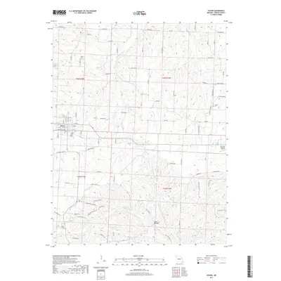
2017 Map of Stover
USGS Topo · Published 2017About this map
Stover sits at the junction of Highway 135 and Highway 52, serving as a concentrated hub of activity in this part of Morgan County. The landscape is defined by the branching drainages of Middle Richland Cr and Gravois Cr, which carve through the terrain toward more significant landmarks like the Devils Backbone. This 2017 survey details a region where traditional rural life and modern infrastructure coexist, shown through the layout of local roads such as Blackberry Patch Rd and Whispering Timbers Rd. For those researching local heritage, several burial sites are clearly marked, including Stover Cem, Saint Paul Cem, and the remote Chaney Chapel Cem. The map also documents Roy Otten Memorial Airfield east of the main township, along with water features like Crystal Lake and Mononame 107 Lake, providing a clear picture of the area's development and land use in the 21st century.
Find a feature on this map
60 named features on this map. Tap any name to fly to it.
Don’t see what you’re looking for? This feature index may not catch every label — zoom into the map to look around manually.
Map Details
Editions of this 2017 Stover Map
This is the sole edition of this map. No revisions or reprints were ever made.
Other maps of this area

1887 · Sedalia
USGS Topo · 1:125,000

1887 · Warsaw
USGS Topo · 1:125,000

1888 · Versailles
USGS Topo · 1:125,000

1888 · Boonville
USGS Topo · 1:125,000

1893 · Versailles
USGS Topo · 1:125,000

1894 · Warsaw
USGS Topo · 1:125,000

1894 · Sedalia
USGS Topo · 1:125,000

1904 · Gravois Mills
USGS Topo · 1:62,500

1935 · Gravois Mills
USGS Topo · 1:24,000

1935 · Proctor Creek
USGS Topo · 1:24,000